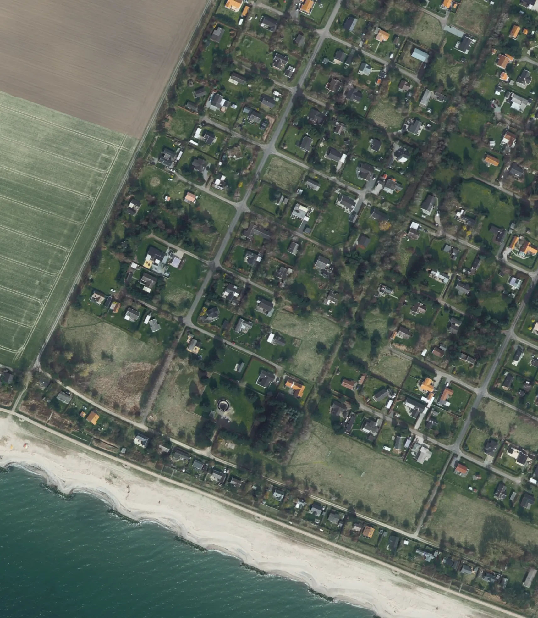
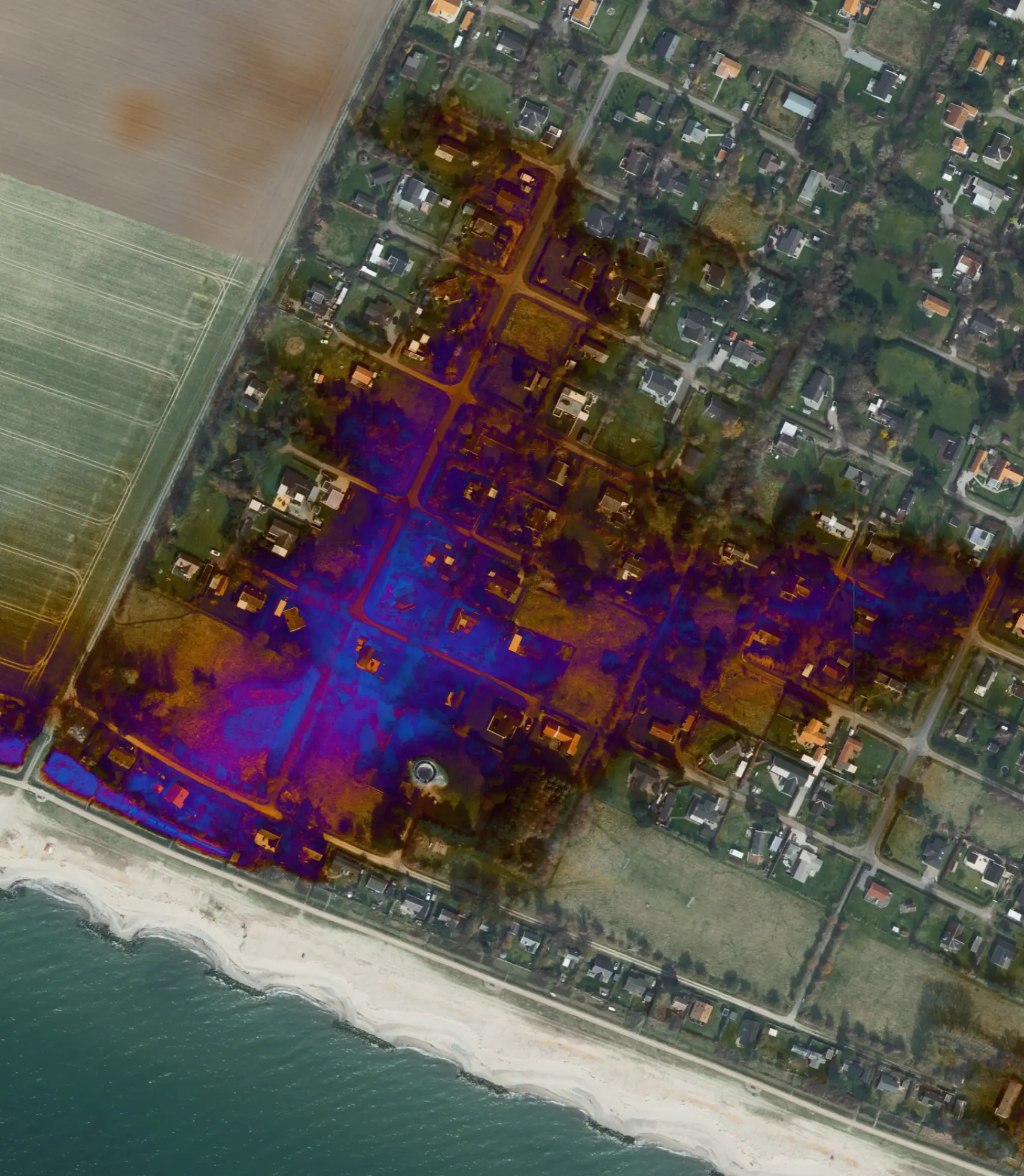
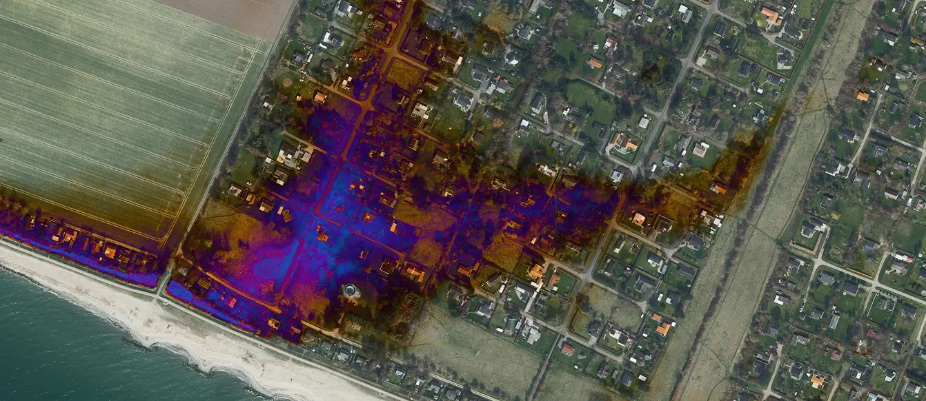
Know the flood risk of every building

Envira Flood enables bank, insurers, and investors to measure and manage climate-driven flood exposure at the individual property level and translate it into financial risk insights.

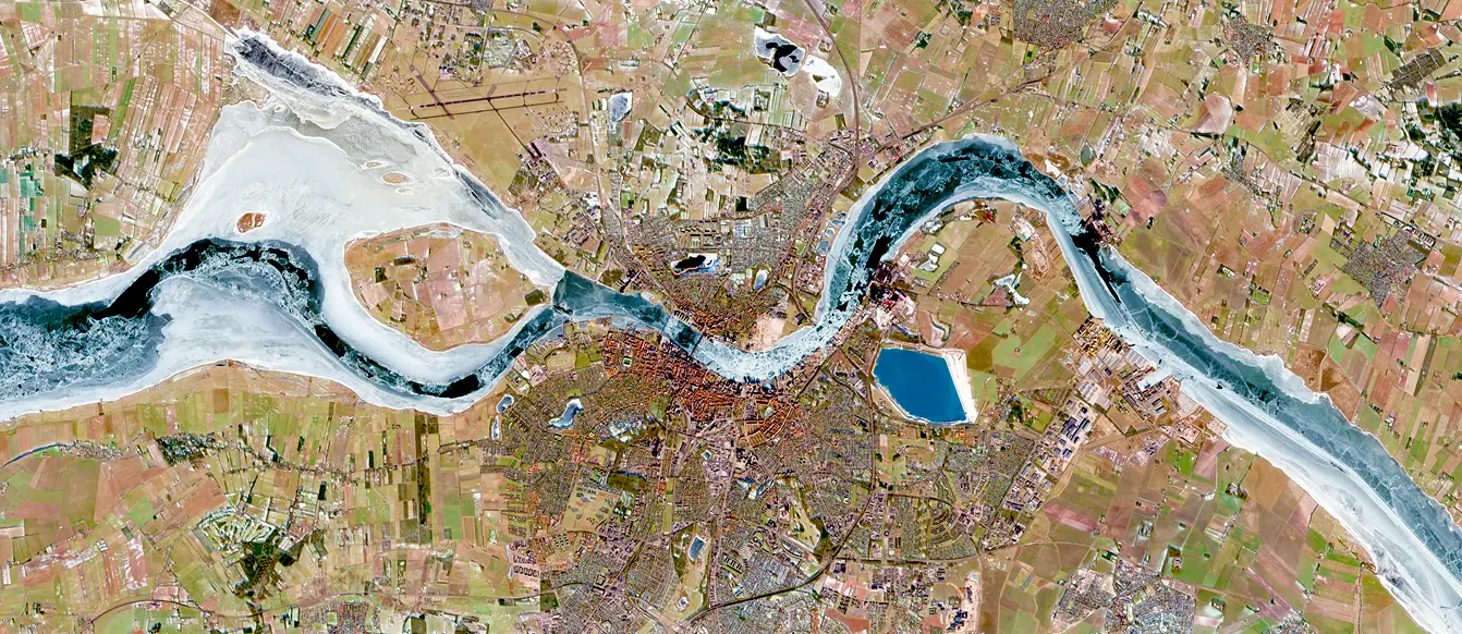
Built on science, Validated by satellite.

Aerial view of a flooded residential area with water surrounding houses and roads near a coastline.

Trusted climate risk intelligence

Logo of Food & Bio Cluster Denmark featuring four petal-like shapes.
Logo and text stating Funded by the European Union NextGenerationEU.
Logo of Food & Bio Cluster Denmark featuring four petal-like shapes.
Logo and text stating Funded by the European Union NextGenerationEU.

Address-level flood intelligence

Flooding is complex. Understanding it shouldn't be.

Envira Flood translates sophisticated climate and terrain data into clear, actionable answers at the individual property level. We don't just give you a risk score; we give you an assessment, presented in a simple traffic-light view that anyone can understand.

Now, you can put this power directly in your customers' hands. Empower homeowners and potential buyers to check the flood risk on a specific property, understand why it's at risk, and see concrete steps they can take to mitigate it.

At the same time, you can screen a single mortgage application, analyze your entire loan portfolio in minutes, and plan for future climate scenarios. This is flood risk you can explain, quantify, and act on  - for your customers and for your business.

Aerial view of a coastal residential area with a sandy beach, green yards, scattered houses, and adjacent farmland.
Aerial view of a coastal residential area with patches of digital overlay showing blue and orange heatmap-like patterns over streets and houses near the beach.

Clarity for Every Workflow

Envira Flood is designed to support your key workflows, from customer-facing tools to internal risk management.

Aerial view of a coastal residential area with fields, houses, roads, and a beach alongside the ocean, overlaid with a colorful heatmap pattern.

01

Empower Your Customers with Actionable Advice

Give your private customers - homeowners and buyers - a simple, instant tool to check flood risk. Our clear reports go beyond a simple score. They explain why a property is at risk and provide concrete mitigation actions they can take. From simple improvements to professional flood-proofing, you empower homeowners to protect their investment.

Aerial view of a city with a winding frozen river running through farmland and urban areas.

02

Set Risk-Adjusted Premiums

For insurers, move beyond broad postal codes. Our address-level data shows you what is likely to flood, allowing you to set fair, accurate premiums based on a property's specific risk profile. The result is pricing you can justify and a healthier, more resilient portfolio.

Aerial view of a triangular-shaped island surrounded by blue-green ocean waters with visible sandbars and waves.

03

Make Confident Lending Decisions

For your internal bank teams, Envira Flood provides the "why" behind the risk. Instantly check flood exposure for any mortgage application. See the recommended mitigation actions for that property, which can be used to guide conversations with the applicant. Use our simple traffic-light system and clear explanations to approve loans, adjust terms, or document your due diligence with confidence.

Aerial view of a farm with buildings and fields partly covered by clouds and shadows.

04

Plan for Future Scenarios

Look beyond today's risk. Model how your portfolio and your customers' properties will be affected 10, 20, or 30 years from now under various climate scenarios. It's the data you need for long-term strategy, regulatory stress tests, and climate adaptation planning.

Aerial view of a coastal residential area with houses, green fields, wooded patches, and a sandy beach with ocean waves.

05

Reports People can act on

Download regulator-ready summaries and customer-friendly property reports. Use the same consistent evidence base to brief credit committees, underwriting teams, and supervisory authorities.

Envira Flood: Risk intelligence for financial decisions

Aerial view of a coastal residential area with fields, houses, roads, and a beach alongside the ocean, overlaid with a colorful heatmap pattern.

Building level data

High-resolution data to measure flood exposure at the individual property level.

Satellite validation

Flood maps are continuously validated and improved by real-world data.
Aerial view of a coastal residential area with fields, houses, roads, and a beach alongside the ocean, overlaid with a colorful heatmap pattern.

Translated into financial risk

Climate exposure converted into financial risk insights. Aligned with regulatory demands.

Built for financial decisions

Aerial view of a coastal residential area with fields, houses, roads, and a beach alongside the ocean, overlaid with a colorful heatmap pattern.
Banks & Mortgage Institutions
Assess individual properties, analyze your exposure, and stress-test your portfolio.
Aerial view of a coastal residential area with fields, houses, roads, and a beach alongside the ocean, overlaid with a colorful heatmap pattern.
Insurance
Improve underwriting with property-level risk pricingUnderstand long-term climate risk across portfolios.
Aerial view of a coastal residential area with fields, houses, roads, and a beach alongside the ocean, overlaid with a colorful heatmap pattern.
Real Estate Investors
Understand long-term climate risk across portfolios.
Contact us
Book demo
Bank icon
Built for financial institutions
Microscope icon
Based on science
Satellite icon
Validated by satellite