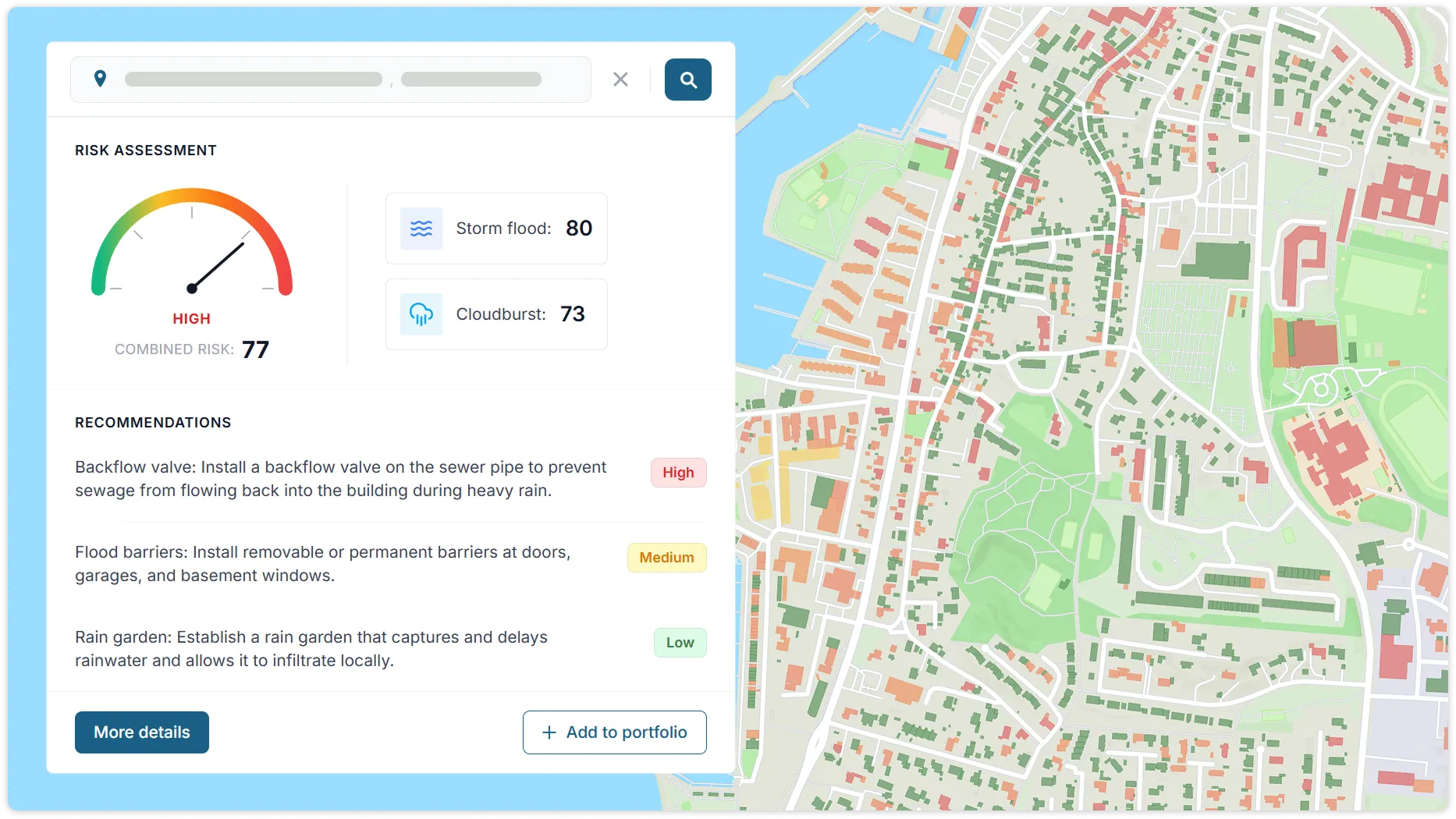
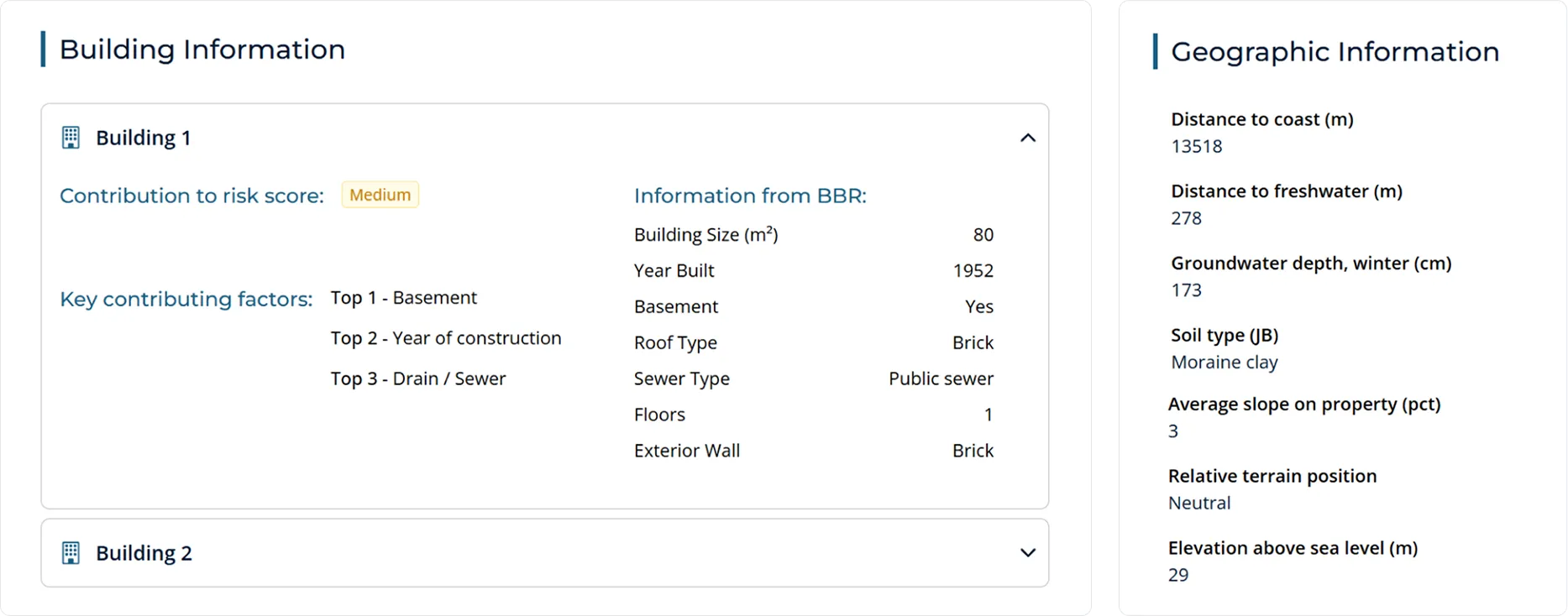
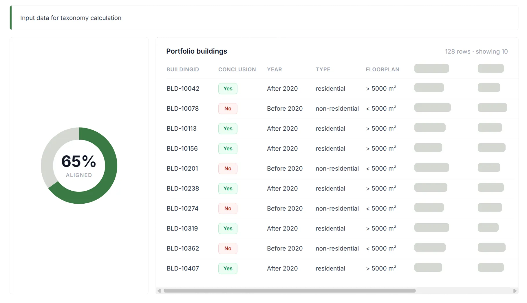
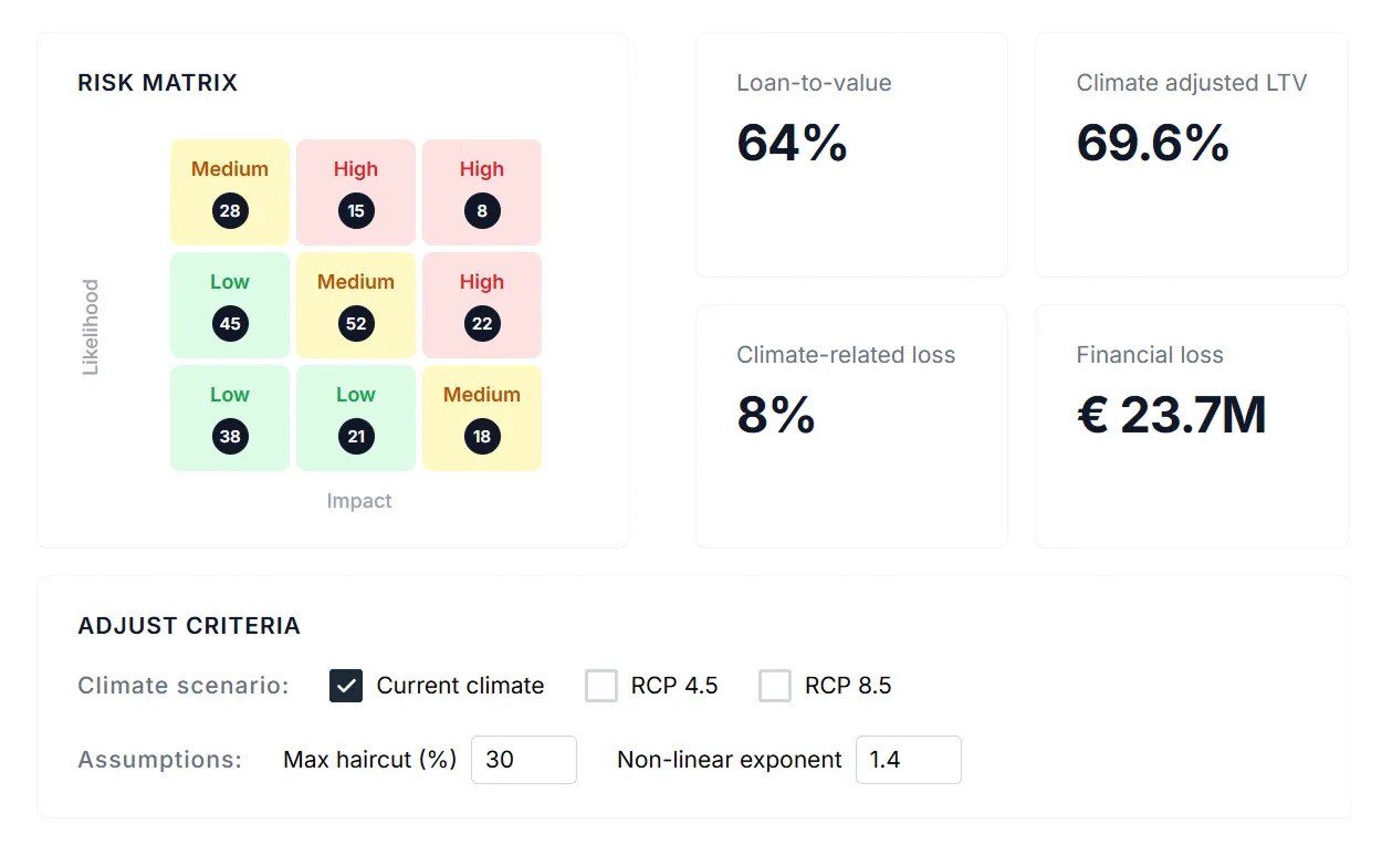
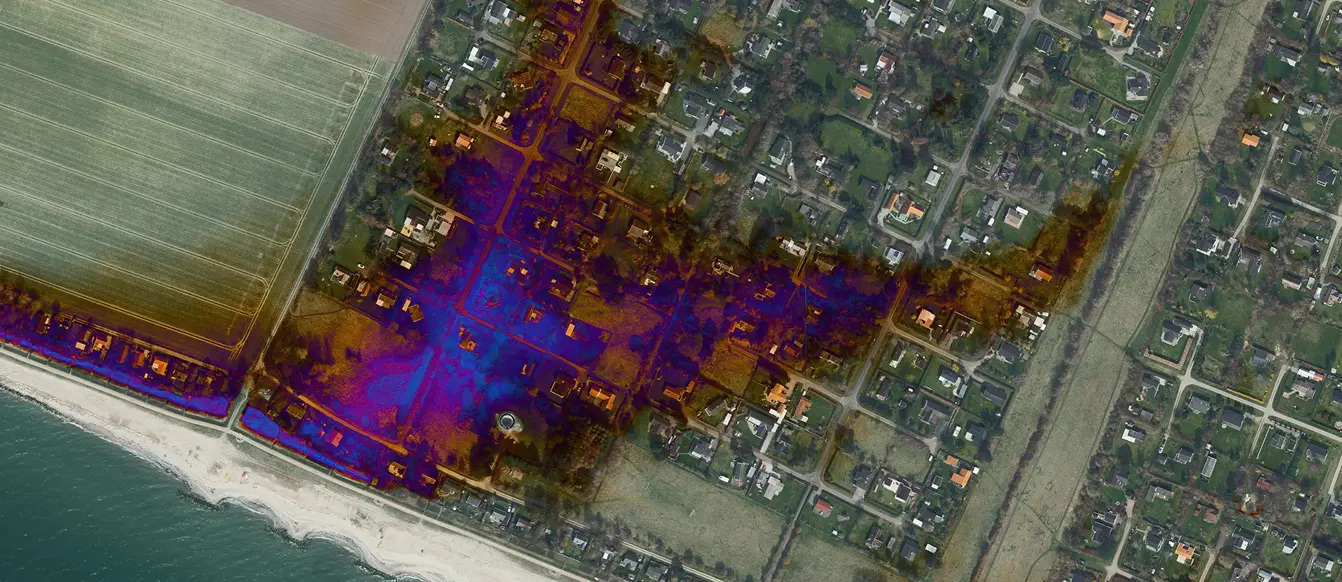
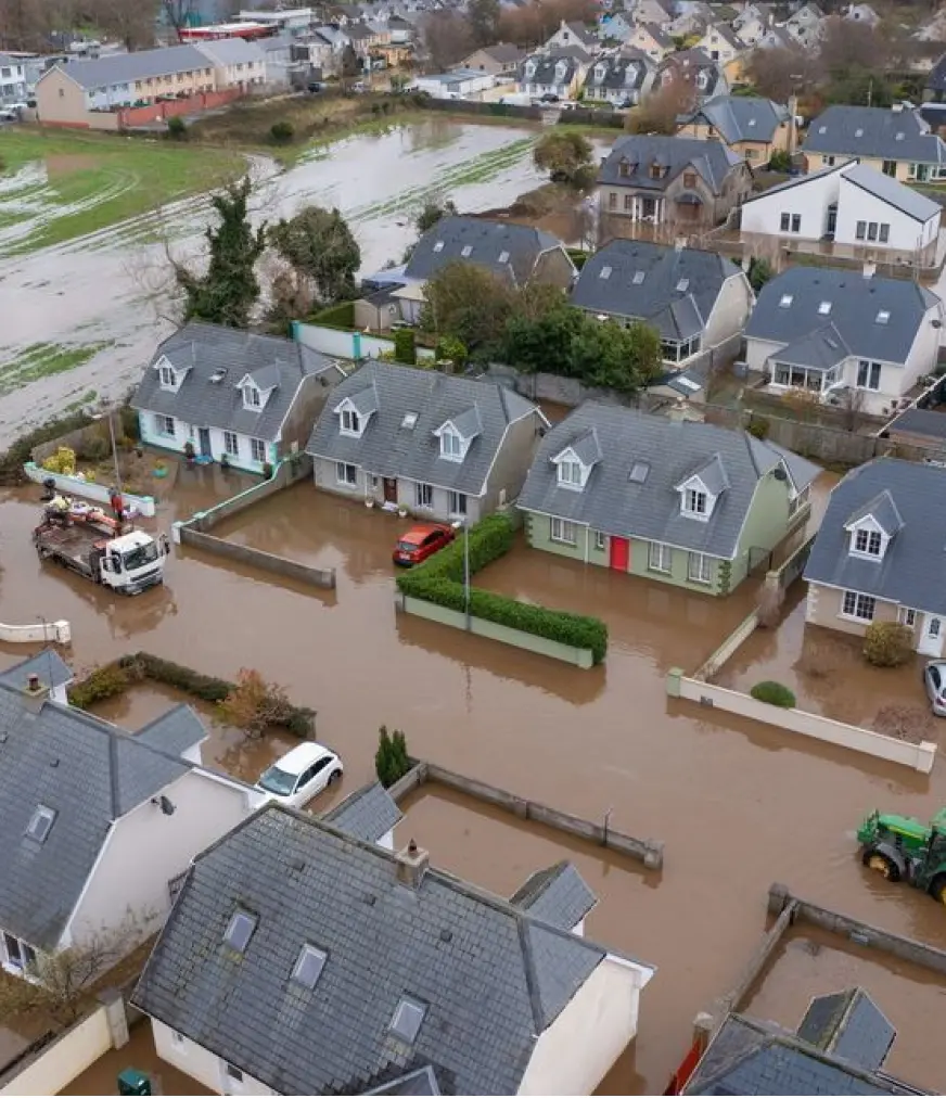
Precise Flood Risk for Every Property

Theodor Christensen
Founder and CEO
Book a demo call with Theodor
Book a demo call with founder
& CEO Theodor
Interested in seeing how our products can help your business? Share your work email below to schedule a quick demo with Theodor.
Success! We’ll be in touch soon.
Something went wrong while submitting.
.webp)


%20(1).jpg)
.webp)
.webp)